Before the Street Number: How Addresses Found Their Form
Before the street number, directions relied on landmarks and local knowledge. See how postal needs helped turn those descriptions into organised addresses.
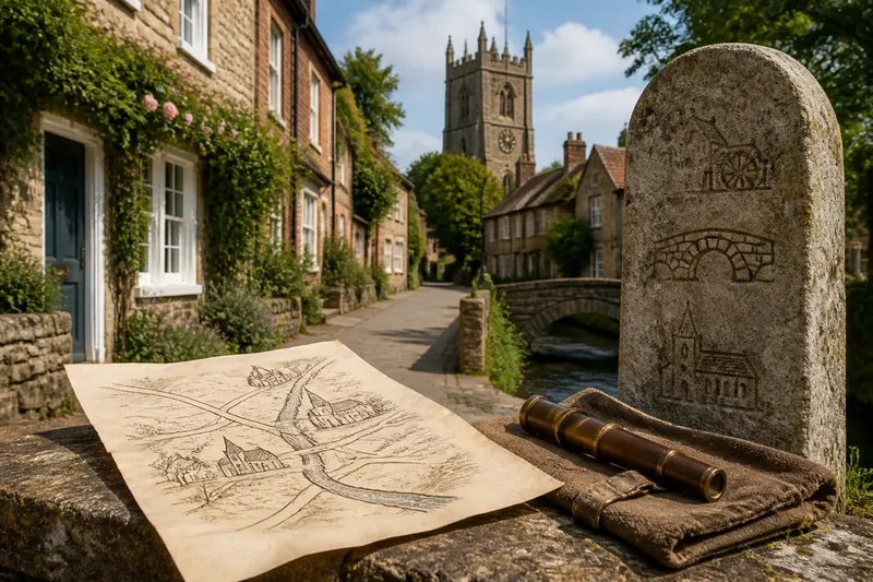
Before the street number, a visitor might be told to follow the lane past the mill, cross the bridge and ask for a house near the churchyard. Such directions could work well for a neighbour who knew the district, yet leave a stranger uncertain. The history of addresses is, in part, the story of how communities tried to make those descriptions travel further.
There was no single moment when the modern address appeared. Different places adapted as their streets, administrations and postal services changed. The shift was from locating a person through local relationships and landmarks towards identifying a place with a more regular set of signs: a street name, a building number, a locality and, eventually, a postal code.
Why did landmarks work before house numbers?
For much of the past, people lived in communities where neighbours could identify one another by name, occupation, family or the location of a familiar building. A direction such as “behind the bakehouse” was useful if the bakehouse was a shared point of reference. A church, market cross, bridge, inn or town gate could serve as a practical anchor.
These directions were not necessarily vague to the people who used them. They belonged to a store of local knowledge: which path flooded, whose cottage stood beyond the orchard, or which turning led towards the market. The description could change as the listener’s starting point changed. Its strength was that it fitted daily life; its weakness was that it depended on knowing the same landscape and people.
Names and landmarks also helped distinguish places when buildings had no formal number. A household might be known by a trade or by a personal name, while a shop could be identified by its sign. In a small settlement, that was often enough for conversation, deliveries and ordinary errands. As streets filled with more houses and residents became less familiar to one another, the same habits became harder to rely on.
What made old directions harder to use?
Growth changed the problem. A settlement could extend beyond its old landmarks, divide one street into several branches, or acquire multiple houses with owners sharing a name. A building once described as “near the mill” might remain after the mill had closed, while a new arrival might not know where the mill had been. Even a familiar landmark could be too broad: a long road might have many homes near a church.
Local directions also placed the burden on the person giving or receiving them. The guide had to know the district, and the visitor had to interpret its customs. A direction might describe a route rather than a stable location. If a gate was shut or a path altered, the recipient could be sent astray without any change to the destination itself.
Imagine a town where several families called Smith live along the road to the river. A messenger who is told to find “the Smith house beyond the inn” may reach the wrong door if the inn has moved or the messenger has never visited the area. Giving each dwelling a position along a named street would offer a more repeatable way to distinguish it. The useful change is not simply a number: it is a shared system for interpreting that number.
How did street names and numbers change the search?
Street naming made the route itself more legible. Instead of describing a destination only by its relation to a landmark, a sender could identify the road. Names might draw on geography, a nearby building, a trade or a local tradition. They gave residents and officials a common label for a stretch of town, even if the name’s history was not obvious to newcomers.
Numbering added an address within that route. In some systems, numbers rise along one side and continue along the other; in others, odd and even numbers face each other. The pattern can depend on local practice and the shape of the street. The point is to make the sequence interpretable, not to follow a universal rule.
Numbering could also help local authorities manage property and public services. A numbered building could be referred to in records without relying on an owner’s name, which might change. Where numbering was introduced, it gave officials, residents and visitors a more consistent way to point to the same place. Yet the arrangement had to be maintained: new buildings, divided plots and renamed roads could all complicate the sequence.
A named street and a number therefore solved different parts of the locating task. The street narrowed the search to a route; the number distinguished one entrance or building from its neighbours. Neither always did the job alone, particularly in rural districts or places where addresses included a house name rather than a number.
Why did postal services encourage organised addresses?
Postal systems had to move letters between people who might never meet. A locally understood direction could guide a neighbour, but a written address needed to remain useful as a letter passed through several hands and sorting points. Consistent place names and a clearer order of address details helped separate one destination from another.
As towns and postal networks expanded, an address could combine a recipient’s name, building or house name, street, town and a broader region. These elements carried the reader from the specific destination outwards, or from the wider area towards the individual building, depending on local convention. Later sorting systems added further codes to identify delivery areas or routes. A postal code supplements the address; it does not necessarily replace the street and building details a person needs at the door.
Organised addresses also made it easier to keep records and communicate across distance. A letter’s destination could be written down and checked without requiring a shared memory of a landmark. The system did not make every place easy to find. It made location information more portable, so someone outside the neighbourhood could use it with less local explanation.
What can still make an address confusing?
Modern addresses retain traces of the uneven transition from local description to formal systems. A house may have a name but no number, a road may be known by a different name locally, or an older building may sit on a route whose official label changed. Rural properties may rely on a locality or property name where street numbering is absent. The address that works for residents is not always the one a form or delivery system expects.
Numbering itself can be less intuitive than it looks. A street may have gaps where plots were never built, numbers may continue around a corner, or a building may contain several flats sharing one street number. A named entrance can face a different road from the one in the postal address. These are not necessarily errors; they reflect the way a local scheme developed or the way a property is divided.
Say you are sending a parcel to a fictional cottage called The Limes on a lane where nearby homes have numbers. If the recipient supplies only the cottage name and village, the carrier may have too little to distinguish it from other named properties. Ask for the full postal address, including the lane and locality, then use that wording consistently on the parcel. The expected result is a destination that can be matched to the local address scheme without relying solely on someone recognising the cottage name.
What address details do people often ask about?
Why do some houses have names instead of numbers?
House names can preserve a local identity, especially where numbered streets are uncommon or a property has long been known by a particular name. In some places the name is the formal address; in others it appears alongside a number or road name.
Why are street numbers sometimes out of sequence?
Gaps can reflect plots that were never built on, properties that were later combined, or a numbering scheme extended over time. A number sequence is a record of administrative choices as well as a way to find a door.
Does a postal code identify a building by itself?
Usually, a postal code identifies an area or delivery grouping rather than serving as a complete description of one entrance. Pair it with the building and street details supplied for that address so the recipient can be identified more precisely.
Which address should I use when local and postal versions differ?
For sending post, use the recipient’s recognised postal address, including its spelling and locality. For visiting, confirm the entrance or access route separately if the building faces a different street or has a named approach.
How should you read an address as a historical record?
An address tells more than where a building stands. It can preserve a former place-name, reveal how a town extended, or show which landmarks once mattered to its residents. A road named for a trade may outlast the workshops that gave it the name; an old house name may point to a feature no longer visible.
Compare the address on an old letter with a current map, and look for changes in street names, spelling and locality. A mismatch does not automatically mean the letter was sent incorrectly: administrative boundaries and naming conventions may have shifted. Local directories, maps and property records can help explain the change, though each reflects the system and period in which it was made.
The movement from landmarks to numbered streets did not erase local knowledge. It added a shared layer that helped strangers, officials and postal workers identify places beyond their own neighbourhood. Before the street number, a destination was often a story about how to reach it; in a modern address, some of that story survives in the street name, house name and the order of the details.
When an address seems awkward, read it as a local system rather than assuming every number follows the same pattern. The street name, building name and postal code each carry a different clue, and together they show how a place learned to make itself findable.